#1 Mt. Esja

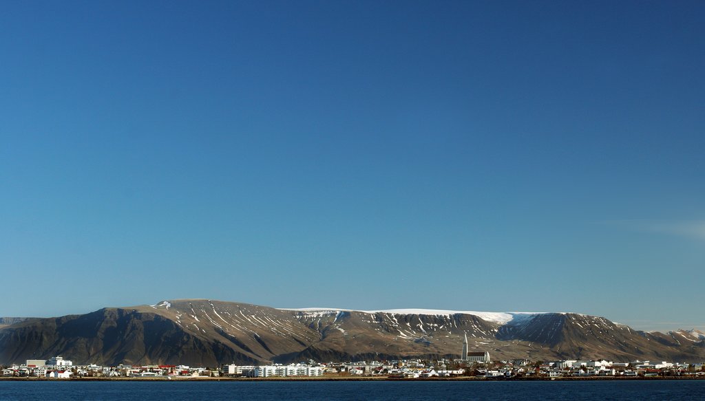
This short hike begins in the countryside just north of Reykjavik. Catch bus #5 from Hlemmur station to Ártun, then transfer to #57 out to Esja Hiking Center. Mt. Esja is home to several hiking trails of varying difficulty, but the simplest route is up to a marker known as Steinn, “the rock.” The trail is steep, but the view over the bay stunning. Beginning from the parking lot, pick a color of painted poles based on difficulty and length. You’ll cross rich vegetation and pick your way across barren scree-filled slopes at the very top. Steinn itself rests at an elevation of 605 m. (1,985 ft.), and the entire hike is just over 3.7 miles (6 km.) round trip.
#2 Glymur Trail

The trail to the tallest waterfall in Iceland, Glymur, is an easy and scenic hike. Make your way past stark canyons, caves and mossy green hills, and through a shallow but vigorous river, until you reach the white falls at 3.08 miles (4.96 km). Though not particularly strenuous, it’s advisable to wear sturdy hiking boots due to the river and a steep gorge. Once at the waterfall, you can turn back or continue to hike up to Botnsa river and Hvalfell mountain.
#3 Landmannalaugar Loop

Landmannalaugar is as picturesque a landscape as they come, with rugged mountains and colorful rhyolite peaks. The Loop is around 3.4 miles (5.47 km) and will take you past barren valleys, up to the base of Mt. Brennisteinsalda, where the slopes have been painted a multitude of colors by falling sulfur. The trail curls back into the Laugahraun lava field, with views of the towering Mt. Bláhnjúkur, the Blue Peak.
#4 Thorsmork Panorama

Thorsmork’s rich wilderness offers a wide range of long and short hike options. Base yourself at one of the Volcano Huts and spend a few days exploring at leisure. An easy hike is Valahnukur, a short loop of 1.5-2 hours, with birch woods, mountain peaks, and incredible 360° views of the valley. To avoid the summer crowds, start early in the morning. Make sure you book your lodging--the huts can sell out months in advance. To really experience this place, you should try to go on the cusp season, early June or September.
Chat with a local specialist who can help organize your trip.
#5 Hverfjall Crater Rim Trail

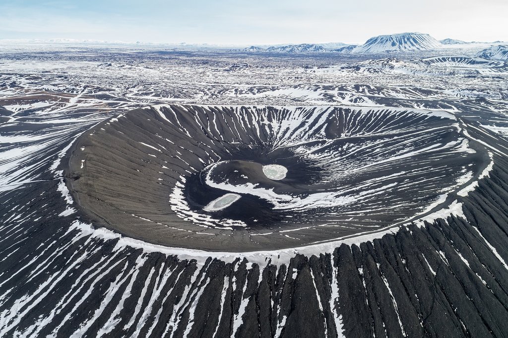
The volcano-rich area of Myvatn is home to several hiking routes that will take you past steaming lava vents, dramatic craters and bizarre lava sculptures. With cold, blackened panoramas, it’s akin to walking on the moon. Hverfjall Crater rim trail starts at Reykjahlíð and takes you through 8.6 miles (14 km) past the hot Grjótagjá Fissure and onto Mt. Hverfjall and then down to the Dimmuborgir lava formations.
#6 Víknaslóðir Routes Borgarfjörður Eystri

Iceland’s little-hyped East Fjords is home to some of the country’s most dramatic terrain, with mountains that slope off into the Atlantic Ocean. The region is also where you can find several pleasant hiking trails, famous among bird-watching enthusiasts. One of the best-marked areas is Víknaslóðir, with its 20-30 routes of varying difficulty. Hike up and you'll enjoy views of the colorful towns and bays, farmsteads that pepper the coast.
#7 Seven Summits

Seyðisfjörður in the East Fjords is home to seven peaks surrounding the fjord, each stretching to more than a 1,000 meters (3,280 feet). Scale all peaks and you'll earn the illustrious badge of “Seyðisfjörður Fjord Mountaineer.” Pick up a logbook at the harbor and get it stamped at the top of each summit as proof of your prowess.
#8 Hengifoss Hike

This hike is ideal for hikers who love waterfalls, as it will introduce you to two. Drive your car through the highlands to Hengifoss, a thick and impressive waterfall, the third highest in Iceland. Climb up the nearby flight of stairs to begin the 1.55-mile (2.5-km) hiking trail. Navigate your way on a long, winding gravel trail, and be sure to watch your step as it can be slippery. Halfway up you’ll spot Litlanesfoss, rushing violently past basalt columns, as well as many small creeks and gorges.
#9 Skaftafell Park Hikes

Skaftafell is a favorite hike for many, easy for families and with excellent views of vatnajökull. If you’re short on time, head out on the inclined hike up to Svartifoss waterfall and Sjónarsker viewpoint, 0.93 miles (1.5 km) from the trailhead. For longer trips, walk around the peak of Kristínartindar, past rocky terrain and rich vegetation, an estimated 3.4 miles (5.5 km).
#10 Skogafoss Waterfall Hike (shortened version of Fimmvörðuháls hike)

Fimmvörðuháls is a long, multi-day hike across volcanic mountain range--but if you’re just wanting to stretch your legs, you can hike well for a few hours past the waterfall before turning back. Located at the top of the popular Skogafoss waterfall, after the initial steep climb upward, it’s a spectacular trail following a series of cascading waterfalls.


